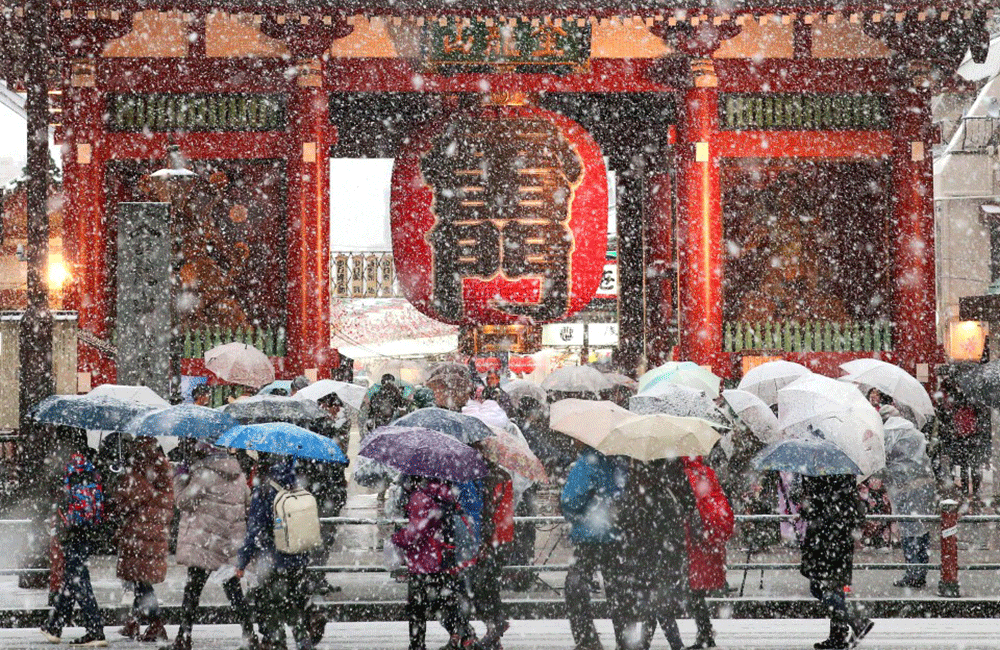
Tokyo experienced its heaviest snowfall in four years this week and other parts of Japan will see sea-effect snow pile up through this week.
An area of low pressure tracked just south of Japan and brought heavy snowfall to the Tokyo area to start this week. This system has now pulled away from Honshu.
Dry and mostly sunny conditions developed Tuesday, but slippery travel remained a concern.
Chilly temperatures will be in place in the Tokyo area Thursday and Friday with highs just above freezing.
Tokyo picked up 23 centimeters, about 9 inches, of snowfall on Monday, making it the heaviest snowfall there since February 2014 when 27 centimeters, or 10.6 inches, was measured. That was also the last time a heavy snow warning was issued for the city.
The heaviest snowfall fell late Monday afternoon into Monday night and impacted the evening commute.
Temperatures reached the upper 40s Fahrenheit, or almost 10 degrees Celsius, on Tuesday, allowing some of the snowfall to melt.
More Snow Ahead?
Locations near the Sea of Japan will continue to experience sea-effect snowfall over the next week. This sea-effect snowfall will be locally heavy at times and will likely result in feet of snow in many spots.
Sea-effect snowfall is similar to lake-effect snowfall. In this case, cold temperatures from Siberia spread toward Japan with northwesterly winds and the Sea of Japan is the moisture source. The higher elevations of the mountains near the coast of the Sea of Japan also enhance snowfall due to upslope flow.
Through Wednesday, 2 feet of snow is possible in the prefectures of Niigata and Toyama, while up to 30 inches may accumulate during this period in Ishikawa prefecture, according to the Japan Meteorological Agency. The chance of snow will continue into early next week, which will add to these snowfall totals.
Heavy snow and snow storm warnings have been issued for much of the coastal areas of Honshu near the Sea of Japan, from Ishikawa prefecture northward, through Wednesday. Portions of western Hokkaido are also under snow storm warnings until at least early Wednesday.
Japan's Sea of Japan side typically sees heavy snowfall in the winter, so this snowy forecast is not unusual.
But snow is more unusual in the Tokyo area due to its location closer to the Pacific Ocean and on the east side of the mountains, as well as its lower elevation. In fact, accumulating snow does not occur here every year.
The average annual snowfall for Tokyo is less than 2 inches. The most common time of the year for snow is January into February when average low temperatures are close to the freezing mark.
Source : weather.com
Leave your comments
Login to post a comment
Post comment as a guest